Central Java Map. cilacapculture.blogspot.com
Hearing word of Banyumas, many people may be will remembered of ‘ngapak’ accent that always make us smile, or imagine the beautiful panorama of Baturaden with its Pancuran tujuh hot spring. For climber, mount slamet would not be forgotten ever. Indeed, Banyumas is rich of beautiful natural objects and friendly people.
Nevertheless, in this article I try to depict another hidden beauty, and many people perhaps do not know or even hear, that is waterfalls in southern Banyumas.
Southern Banyumas I mean here is an east-west elongated folded mountain which is located in the south of river Serayu, therefore geologists call it Southern Serayu mountain. Further to the south, a wide lowland, called as Cilacap lowland, extends parallelly with this mountain and bordered by Indian Ocean in the south.
When my friends and I visited village Kemawi, distric Somagede, I got information from the local residents that many beautiful waterfalls surrounded that area, but is still rarely visited by tourists. Without wasting time, I asked to a local resident to accompany us went there, as well as guide.
Village Kemawi itself is located on the centre of Southern Serayu mountain exactly, on the anticline hinge of this folded mountain. It is about five hundreds meters above sea level and the air is fresh enough in the morning. Albizia, rubber tree, durian, jengkol, coconut, and crops are dominant vegetations here.
Back to the waterfalls, Gumawang waterfall is the first waterfall we visited. We could reach this object by riding car until the nearest small town. The road is well asphalted and lake Tapak Bima seen on the left side. It called ‘tapak bima’ because of its form like human footprint. After about two kilometers on riding, the road became narrows and very slippery. Across the inhabitant garden, as close to the waterfall, the road became a footpath. To reach the waterfall itself, we had to walk down the slope as deep as approximately a hundred meter. Along the walk down, we could see beautiful panorama of Gumawang valley.
Gumawang waterfall
After about one hour walk down, we could see the beautiful Gumawang waterfall. This waterfall actually has three levels and each separated by approximately ten meters wide pools. The big debit water is clear, except in rainy season, and falls among andesite rock that shows imperfect pillow lava structure. In the left side, another waterfall falls among breccias rock, much less in debit but as high as the Gumawang’s.
Playing under the second level waterfall
Not far from Gumawang waterlfall, in Karangaren town, there is another big water debit waterfall, Klapa waterfall. The water runs down through breccias wall as high as approximately 30 meters and looked like waved curtain or white grandmother’s hair.
This waterfall is different with Gumawang flow. The water is clearer, and many little pools, about 2 untill 3 meters in diameter, above and under the main waterfall, looked like natural jacuzzies. It is unfortunate if you visit it without swimming.
the pool, want to swim?
The third waterfall is still anonymous. It is located in the north of the centre of village Kemawi. This waterfall has five levels and each has approximately five until seven meters high. The water runs down the seventy until sixty degree andesite breccias cliff, therefore we could climb it easily enough. On the top of this waterfall, we could take a rest by viewing to the north, enjoy the beautiful Banyumas basin scenery which drained by meandering river Serayu. Mount Slamet could be seen standing gallantly in the distance with its white smoke whiff.
the third waterfall
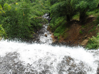
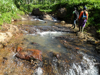
There are still many another wonderful waterfalls you can visit, still anonymous, still on South Serayu mountain, and you can enjoy some of its picture below.


Tidak ada komentar:
Posting Komentar